PLANNING, MAPPING, & ECONOMIC DEVELOPMENT DEPARTMENT
GIS MAPPING & ANALYSIS
WHAT WE DO
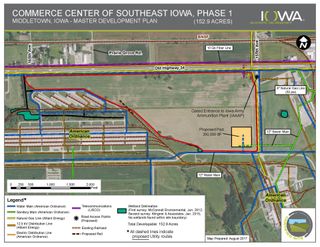
SEIRPC’s planning staff offers a full range of mapping and Geographic Information System (GIS) services, creating attractive maps for use in planning documents, marketing and promotional pieces, grant applications, site plans and economic development materials, as well as stand-alone navigational maps for our communities and counties.
Our planners regularly maintain geospatial data including railroads, roadways, water features, corporate limits, points of interest such as recreational amenities, schools, hospitals, transit facilities etc. Staff also collects GIS data from public and private partners such as aerial imagery, parcels, demographic and economic data, floodplain, soil types, trails and more. We carefully analyze all this data to prepare clear and eye-catching maps and reports.